With more options available than ever, how do you find the right reality capture solutions?
Reality capture technology has made significant strides in recent years. What began as specialised solutions for surveyors has evolved into robust and accessible technology that has transformed fields such as architecture, engineering, construction, and infrastructure.
However, with this rapid advancement comes a new challenge: selecting the right tool for the task at hand. From high resolution 3D scanners and mobile mapping systems to quality imaging solutions with automated data insights, the options available today are more capable and diverse than ever.
With accurate 3D data, visually engaging point clouds and greater insights, reality capture technologies digitise existing structures and facilitate smarter decision-making.
But not all solutions are created equal. Whether you’re capturing data for a comprehensive scan-to-BIM (Building Information Model) workflow or aiming to produce clean 3D models for digital insights, it’s essential to grasp the distinctions among reality capture solutions.
Precision, speed, portability and ease-of-use
Selecting the appropriate scanning tool necessitates understanding each available solution’s specific characteristics.
Options such as terrestrial laser scanning (TLS), mobile mapping and imaging laser scanners each provide varying degrees of accuracy, usability and application. The nature of the projects, the team’s expertise level and the specific insights required from the 3D data should guide the decision-making process.
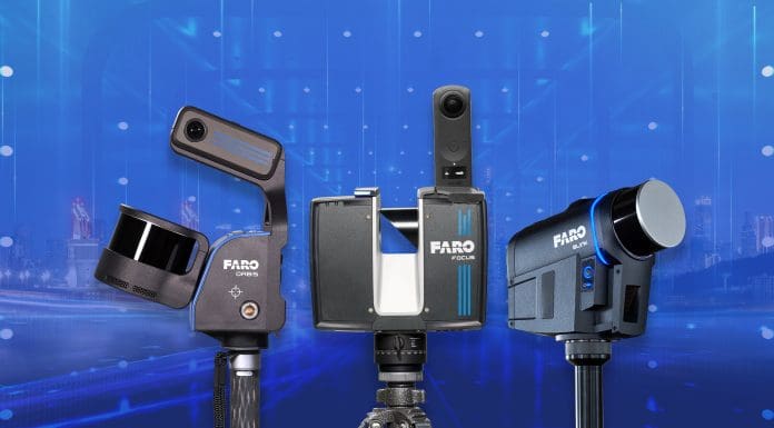
What follows is a summary of key offerings within the FARO reality capture portfolio.
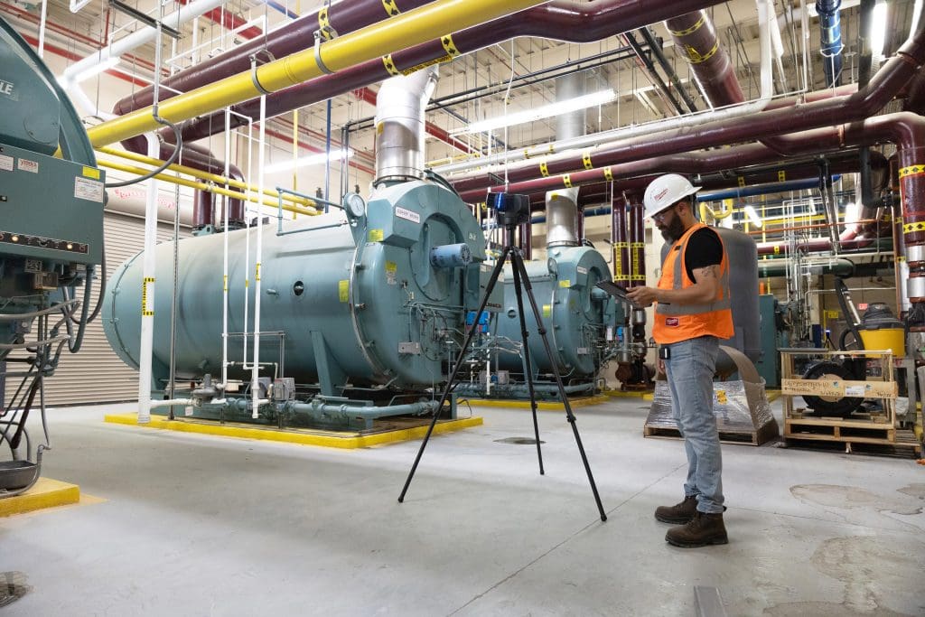
The FARO® Focus Laser Scanner represents the pinnacle of precision.
Boasting extremely high accuracy of up to 2mm, the tripod-mounted 3D laser scanner captures millions of data points from a fixed position, generating ultra-dense point clouds that can be converted into detailed 3D maps of as-built structures and terrain.
This level of detail makes the LiDAR solution indispensable for environments where accuracy cannot be compromised, like detailed scans for BIM workflows or high-stakes industrial projects. Partly due to this high precision, the scanner naturally requires higher expertise, necessitating a solid understanding of scanning best practices to maximise your efficiency on-site.
FARO® Orbis Premium Mobile Laser Scanner is known for its speed, versatility and high-quality output. By merging LiDAR technology with 360-degree images, Orbis provides exceptional data and visuals in one compact, handheld device. Moreover, this scanner can be mounted on a backpack for navigating rugged terrains like forests or attached to a vehicle mount to cover larger areas efficiently and quickly. Designed for quick, efficient use, Orbis often allows a complete scan in one go.
While it’s considered an intermediate scanner, it still involves some mobile scanning nuances, such as ensuring to “close the loop” – finishing a scan where you started. Users can expect mobile scan precision of up to 5mm, and Flash stationary scan precision of up to 2mm.
When it comes to ease of use the FARO® Blink Imaging Laser Scanner really shines, speeding up reality capture in ways architects, engineers and construction professionals are just beginning to realise.
This sleek tripod-based system combines rich 36-degree images with point cloud data. Its user-friendly design, guided scanning and automatic insights through FARO Sphere XG, the company’s cloud-based digital reality platform, along with offline data processing, make it the ideal solution for professionals seeking quick data collection, quality visuals and effortless setup.
The simplest scanner to master, Blink features one-button operation, offers guided scanning and provides automatic insights, making it accessible at all experience levels.
A note on image quality
As evidenced from above, it’s not always strictly about point clouds; high-quality images help share and understand reality capture data, facilitate clear communication among stakeholders and lead to improved project reviews.
Orbis excels in this area, as it produces high-quality images with Flash technology at 70 megapixels, alongside 3D data it captures. And for Focus, with the added benefit of quicker Flash scanning, this TLS produces highly accurate point clouds which can be converted into stunning 3D maps.
Mobile mapping devices also deliver quality visuals across larger areas and while TLS prioritises accuracy, modern scanners are often equipped with internal and/or external cameras to elevate the final deliverables further.
Orbis Premium, for instance, automatically captures many images during a standard scan at a good quality level. Additionally, it provides exceptionally high-quality 360-degree visuals from a fixed Flash scanning position.
Blink, whose name evokes the shutter of a camera, is truly an image-first solution first, delivering high-quality 360-degree visuals with faster scanning times. Complemented by good point cloud accuracy, Blink provides quick, client-ready results and detailed imagery.
Bringing it all into focus (or Orbis and Blink)
In today’s competitive market, various reality capture solutions can overwhelm anyone with each solution’s varying specs, formats and features. However, selecting the right technology doesn’t have to be complicated. It begins with clearly identifying your needs/project objectives and understanding how each tool integrates into your existing workflows. Whether you prioritise speed, precision or ease of use, there’s a straightforward path ahead.
Consider this article a convenient conversation starter as you begin – or enhance – your ongoing reality capture technology journey.
*Please note that this is a commercial profile.
The post Rethinking reality capture tech: Choosing the best solution(s) that’s right for you appeared first on Planning, Building & Construction Today.